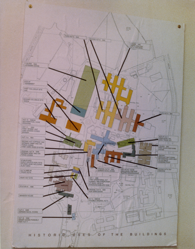
Map of Bletchley Park in the U.K. with buildings used during World War II
Catalog Number
102652255
Type
Still Image
Description
This is a color image of an aerial map view of buildings located throughout Blechley Park in the United Kingdom used during World War II for deciphering the German Enigma codes and other cryptography missions. The map is pinned against a tan wall. The map contains several buildings in different colors (green, tan, yellow, rust, light blue) with black lines leading from those building to a box with text describing their significance. The caption of the map is "Historic Uses of the Buildings"